
Flood Outlook - Lower Ottawa River
Flood Outlook — Lower Ottawa River
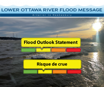
A Flood Outlook Statement is being issued for areas along the Lower Ottawa River (Arnprior to Hawkesbury).
A large weather system brought 10 to 20 mm of precipitation over much of the Ottawa River basin between March 15th and 17th. This system also brought warm temperatures that triggered a rapid melting of snow in the southern portion of the Ottawa River, marking the beginning of the spring freshet in the Ottawa River basin.
In mid-March, the amount of water in the snow cover was close to average throughout the watershed. A portion of the snow cover, over a large part of the basin, has melted over the last few days, with a higher portion in the southern part of the basin.
Rising levels along the main stem of the Ottawa River could create possible flooding in low-lying areas over the coming weeks. Low-lying areas are those that are regularly flooded during the spring freshet period.
While there are currently no flooding indicators of concern, it is still too early to forecast peak river conditions which remain dependent on snowmelt and rainfall amounts.
Residents in flood-prone areas are encouraged to closely follow changing conditions and to take necessary measures. Residents are advised to stay away from watercourses where flows are high and where banks might be unstable. Parents are encouraged to explain dangers to children and provide appropriate supervision around all waterbodies.
The Mississippi Valley, Rideau Valley, and South Nation Conservation Authorities monitor water levels and weather forecasts with the Ministry of Natural Resources aspart of the Flood Forecasting and Warning Program. Updates are provided as conditions change.
The Ottawa River Regulating Committee will be reassessing forecast conditions and providing hydrological condition updates on its website daily at www.ottawariver.ca/forecasts/.
To view current flood warnings across Ontario, visit: www.ontario.ca/law-and-safety/flood-forecasting-and-warning-program.
This FLOOD OUTLOOK STATEMENT is in effect until April 1, 2025 at 5:00 PM.
South Nation Conservation
Katherine Watson,
Coordinator, Early Warning Systems and Watershed Plans
613-984-2498 | kwatson@nation.on.ca
Definitions:
- Water Conditions Statement: Water Safety: indicates that high flows, melting ice or other factors could be dangerous for such users as boaters, anglers, and swimmers but flooding is not expected.
- Water Conditions Statement: Flood Outlook: gives early notice of the potential for flooding based on weather forecasts calling for heavy rain, snow melt, high winds, or other conditions.
- Flood Watch: potential for flooding exists within specific watercourses and municipalities.
- Flood Warning: flooding is imminent or occurring within specific watercourses and municipalities.
— end —