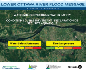
Water Conditions Statement: Water Safety — Lower Ottawa River

A Water Safety Statement is being issued for areas along the Lower Ottawa River (Arnprior to Hawkesbury).
This winter has been characterised by unseasonably warm temperatures, below-average precipitation in many locations and several melt events. As of mid-March, the amount of water in the snowpack is well below average for this time of year across the Ottawa River watershed. The snow is essentially gone in the south-east portion of the basin and well below average elsewhere for this time of year.
Environment Canada is forecasting cooler, more seasonable, temperatures for the next week. Temperature highs from Thursday to the weekend will remain near or below zero, with subzero temperatures overnight. With the cool weather, some snow is forecasted throughout the region.
The water levels and flows on the Ottawa River are currently elevated in some locations for this time of year because of the early spring-like weather. Although it’s too early to forecast the magnitude and timing of the peak on the main stem of the Ottawa River, the weather experienced over the last couple of weeks could constitute a mild start of freshet. However, it’s not possible to completely rule out the occurrence of flooding this early in the year. Weather conditions over the coming weeks (such as additional snowfall and heavy rainfall events) will influence the strength of the freshet. Often, these weather conditions only become certain a few days in advance.
Residents in flood-prone areas are encouraged to closely follow changing conditions and to take necessary measures. Residents are advised to stay away from watercourses where flows are high and where banks might be unstable. Parents are encouraged to explain dangers to children and provide appropriate supervision around all waterbodies.
The Mississippi Valley, Rideau Valley, and South Nation Conservation Authorities monitor water levels and weather forecasts with the Ministry of Natural Resources and Forestry as part of the Flood Forecasting and Warning Program. Updates are provided as conditions change.
The Ottawa River Secretariat will be reassessing forecast conditions and providing hydrological condition updates on its website when the freshet begins or if wet weather leads to flood risks www.ottawariver.ca/forecasts.
To view current flood warnings across Ontario, visit: www.ontario.ca/law-and-safety/flood-forecasting-and-warning-program
This WATER SAFETY STATEMENT is in effect until April 8, 2024 at 5:00 PM.
South Nation Conservation
MEDIA CONTACT:
Erin Thorne, Communications Specialist, ethorne@nation.on.ca, 1-877-984-2948.
FLOOD DUTY OFFICER:
Katherine Watson, Coordinator - Early Warning Systems and Watershed Plans, kwatson@nation.on.ca, 1-877-984-2948.
Definitions:
- Water Conditions Statement: Water Safety: indicates that high flows, melting ice or other factors could be dangerous for such users as boaters, anglers, and swimmers but flooding is not expected.
- Water Conditions Statement: Flood Outlook: gives early notice of the potential for flooding based on weather forecasts calling for heavy rain, snow melt, high winds, or other conditions.
- Flood Watch: potential for flooding exists within specific watercourses and municipalities.
- Flood Warning: flooding is imminent or occurring within specific watercourses and municipalities.

