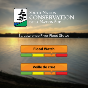
FLOOD WATCH: St. Lawrence River (Update #4)

This is an update to the Flood Watch statement issued by South Nation Conservation (SNC) for the St. Lawrence River on May 1st, 2020.
Weather Forecast:
General rainfall of up to 20 to 30 mm with a chance of moderate thunderstorms are in the forecast for Eastern Ontario starting Sunday, May 17th into Monday, May 18th.
Environmental Conditions:
According to the International Lake Ontario – St. Lawrence River Board, Lake Ontario’s water levels are above average for this time of year, and will likely reach or nearly reach levels observed at this time in 2019 in the coming week as a result of recent heavy precipitation.
High inflows from Lake Erie continue into Lake Ontario, which means Lake Ontario will continue its seasonal rise and may remain near seasonal highs for the next several weeks. Outflows from Lake Ontario continue to be maximized to the extent possible.
Lake Ontario’s water levels rose to 75.36 m this week; 33 cm above average; but 47 cm below those observed at this time in 2017; and 31 cm below levels observed at this time in 2019.
If mild weather persists, Lake Ontario’s water levels are expected to peak well below the record highs of 2017 and 2019. Lake Ontario is expected to begin its seasonal decline in the coming weeks depending on weather conditions.
Risks:
Levels in Lake Ontario influence levels in the upper St. Lawrence River, particularly from Kingston to Iroquois, including Maitland, Johnstown and Cardinal.
As Lake Ontario continues to rise above 75.30 m, there is increased potential for shoreline flooding, flooding in low-lying areas, basement and septic system inundation,
and wave-driven erosion.
Residents are advised that strong winds may cause large waves, further aggravating water levels which may affect structures close to shore.
ACTION:
Residents are advised to stay away from rivers as forecasted weather may rapidly increase river flows, and banks might be unstable and slippery. Parents are encouraged to explain these dangers to their children.
Residents in flood prone or low-lying areas, historically susceptible to flooding, should take the necessary precautions to protect their property, such as:
- Ensuring sump pump is clear, in good working condition and has a backwater valve on it.
- Portable backup generator and pump.
- Ensuring downspouts are clear and the outlet is at least 3 m from
the dwelling. - Removing or securing items that might float away as flows increase.
- Removing valuable items from basements or lower floors that could be subject to flooding.
- Keep emergency phone numbers handy.
- Familiarize yourself with your municipality’s emergency preparedness plan.
Duration:
This Flood Watch statement is in effect until Friday, May 29, 2020.
SNC monitors the water levels and weather forecasts as part of the Flood Forecasting and Warning Program. Updates are provided as conditions change.
The International Lake Ontario – St. Lawrence River Board continues to monitor conditions on an ongoing basis. Information on hydrologic conditions, water levels and outflows, including graphics and photos, are available on the Board’s website at www.ijc.org/en/loslrb.
Please visit www.nation.on.ca for more information. To provide feedback with respect to changes in water related conditions please email waterwatch@nation.on.ca, posted on our Facebook (/SouthNationConservation) or Twitter (@SouthNationCA).
FOR MORE INFORMATION: Geoff Owens, SNC Regulations Officer,
613-551-9170, gowens@nation.on.ca
MEDIA CONTACT: Taylor Campbell, SNC Communications Specialist,
613-551-7158, tcampbell@nation.on.ca.
Forwarded to: All Flood Forecasting and Warning Directory
###

