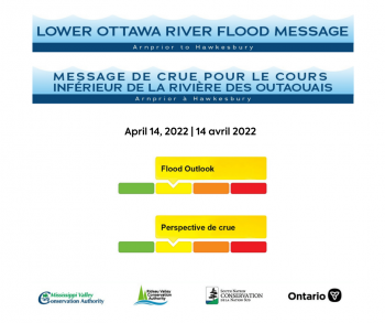
Water Conditions Statement: Flood Outlook — Lower Ottawa River

A Flood Outlook Statement is being issued for areas along the Lower Ottawa River (Arnprior to Hawkesbury). Based on forecasted precipitation and anticipated snow melt, levels and flows along the Ottawa River are expected to increase over the next few days as a result of the onset of the spring freshet in the Ottawa River basin.
Snow cover varies significantly across the 146,300 km2 Ottawa River basin, with most southern areas having no snow cover at all. A large portion of snow cover in the northern regions had near-average water content at the end of March.
Based on current weather forecasts, minor flooding may occur in low-lying areas generally susceptible to flooding along the Lower Ottawa River starting this weekend. Levels are not expected to exceed the peak levels observed in 2020, and little to no impact to houses and buildings is expected. Water levels are currently expected to remain below major flood thresholds in all locations.
While there are currently no flooding indicators of concern, it is still too early to forecast peak river conditions which remain dependent on rainfall amounts received and snowmelt.
Residents in flood-prone areas are encouraged to closely follow changing conditions and to take necessary measures. Residents are advised to stay away from watercourses where flows are high and where banks might be unstable. Parents are encouraged to explain dangers to children.
The Mississippi Valley, Rideau Valley, and South Nation Conservation Authorities monitor water levels and weather forecasts with the Ministry of Northern Development, Mines, Natural Resources and Forestry aspart of the Flood Forecasting and Warning Program. Updates are provided as conditions change.
The Ottawa River Regulating Committee will be reassessing forecast conditions and providing hydrological condition updates on its website daily at www.ottawariver.ca/forecasts/.
To view current flood warnings across Ontario, visit: www.ontario.ca/law-and-safety/flood-forecasting-and-warning-program. A reference map from the ORRC with snow pack measurements from March 2022 is attached.
This FLOOD OUTLOOK STATEMENT is in effect until April 27, 2022 at 5:00 PM.
South Nation Conservation Authority
MEDIA CONTACT: Shannon Gutoskie, Communications Specialist, sgutoskie@nation.on.ca, 1-877-984-2948.
FLOOD DUTY OFFICER: Katherine Watson, Water Resources Specialist – Engineering, kwatson@nation.on.ca, 1-877-984-2948.
Definitions:
- Water Conditions Statement: Water Safety: indicates that high flows, melting ice or other factors could be dangerous for such users as boaters, anglers, and swimmers but flooding is not expected.
- Water Conditions Statement: Flood Outlook: gives early notice of the potential for flooding based on weather forecasts calling for heavy rain, snow melt, high winds, or other conditions.
- Flood Watch: potential for flooding exists within specific watercourses and municipalities.
- Flood Warning: flooding is imminent or occurring within specific watercourses and municipalities.
— end —

