
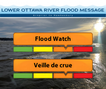
Flood Watch — Lower Ottawa River
This FLOOD WATCH statement is an update to the Flood Outlook Statement issued for areas along the Lower Ottawa River (Arnprior to Hawkesbury) on April 11th, 2025.
The Ottawa River Regulating Committee warns that weather events over the next few weeks, in particular events bringing above normal temperatures and heavy rainfall, may lead to levels and flows exceeding flood levels in some locations.
Water levels and flows have been gradually increasing at several locations along the main stem of the Ottawa River. Levels and flows may continue to increase over the next few weeks due to forecasted rain and increased spring runoff from warmer temperatures and snow melt contributions from outside of the Ottawa Valley.
Minor flood levels may be exceeded in flood prone areas along the river between Lake Coulonge and Carillon (Pembroke to Hawkesbury) starting Saturday, April 26. The minor flood level is defined as the level at which parts of some streets, lawns and parks are beginning to flood, with no or few houses/buildings being affected.
While there are currently no major flooding indicators of concern, it is still too early to forecast peak river conditions which remain dependent on snowmelt and rainfall amounts.
Residents in flood-prone areas are encouraged to closely follow changing conditions and to take necessary measures. Residents are advised to stay away from watercourses where flows are high and where banks might be unstable. Parents are encouraged to explain dangers to children and provide appropriate supervision around all waterbodies.
The Mississippi Valley, Rideau Valley, and South Nation Conservation Authorities monitor water levels and weather forecasts with the Ministry of Natural Resources aspart of the Flood Forecasting and Warning Program. Updates are provided as conditions change.
The Ottawa River Regulating Committee will be reassessing forecast conditions and providing hydrological condition updates on its website daily at www.ottawariver.ca/forecasts.
To view current flood warnings across Ontario, visit: www.ontario.ca/law-and-safety/flood-forecasting-and-warning-program.
This FLOOD WATCH STATEMENT is in effect until May 21, 2025 at 5:00 PM.
South Nation Conservation
Contact: Kat Watson,
Coordinator, Early Warning Systems and Watershed Plans
kwatson@nation.on.ca 1-877-984-2948.
Definitions:
- Water Conditions Statement: Water Safety: indicates that high flows, melting ice or other factors could be dangerous for such users as boaters, anglers, and swimmers but flooding is not expected.
- Water Conditions Statement: Flood Outlook: gives early notice of the potential for flooding based on weather forecasts calling for heavy rain, snow melt, high winds, or other conditions.
- Flood Watch: potential for flooding exists within specific watercourses and municipalities. Municipalities, emergency services and individual landowners in flood-prone areas should prepare.
- Flood Warning: flooding is imminent or occurring within specific watercourses and municipalities.